Ballistic Missile Defense System Sensors
Sea-Based X-Band radar (SBX)
Aug. 20, 2011
The SBX departs Vigor Shipyards after completing three months of scheduled maintenance and planned upgrades.
(Photos courtesy of LTC Steve Braddom)


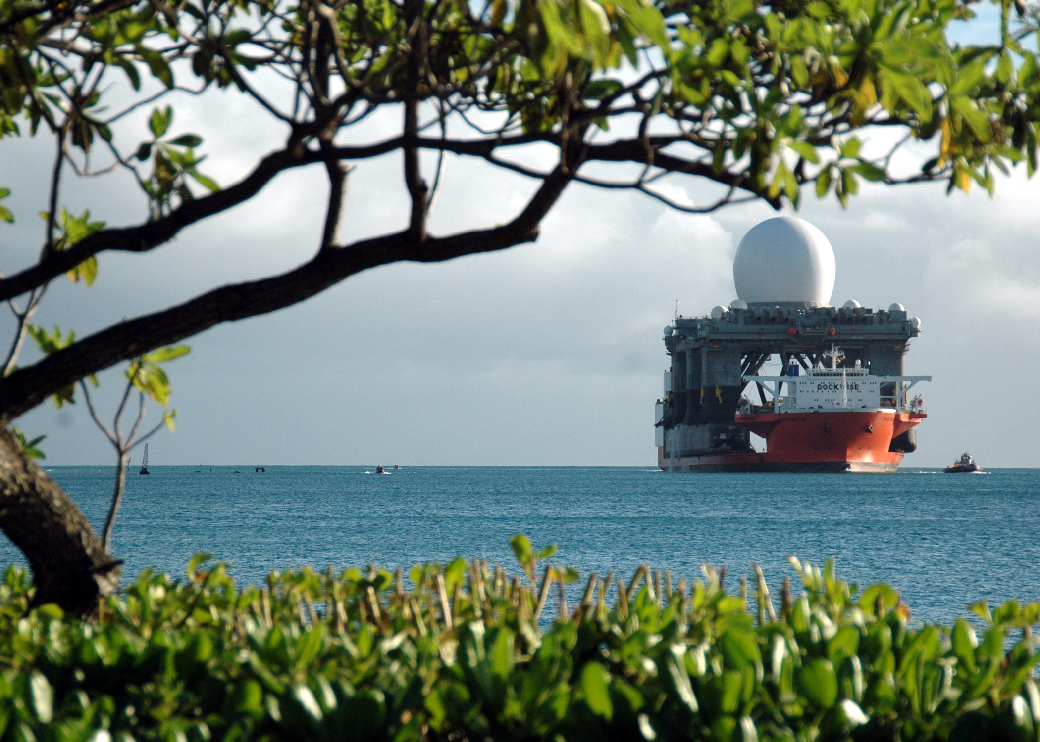
May 11, 2011
Video footage of the SBX radar traveling towards Vigor Shipyards Seattle.

May 10, 2011
SBX passes the Seattle skyline as it enters Elliott Bay just before arriving at Vigor Shipyards Seattle. Missile Defense Agency photos.
(Last five photos courtesy of LTC Steve Braddom)


March 20, 2007
On March 20, 2007, the SBX radar and two Aegis ships using onboard SPY-1 radar, successfully tracked a Minuteman II target missile as it was launched from Vandenberg Air Force Base, Calif. The largest radar of its type, the SBX is designed to track and discriminate small objects in space, which makes it especially effective for missile defense.


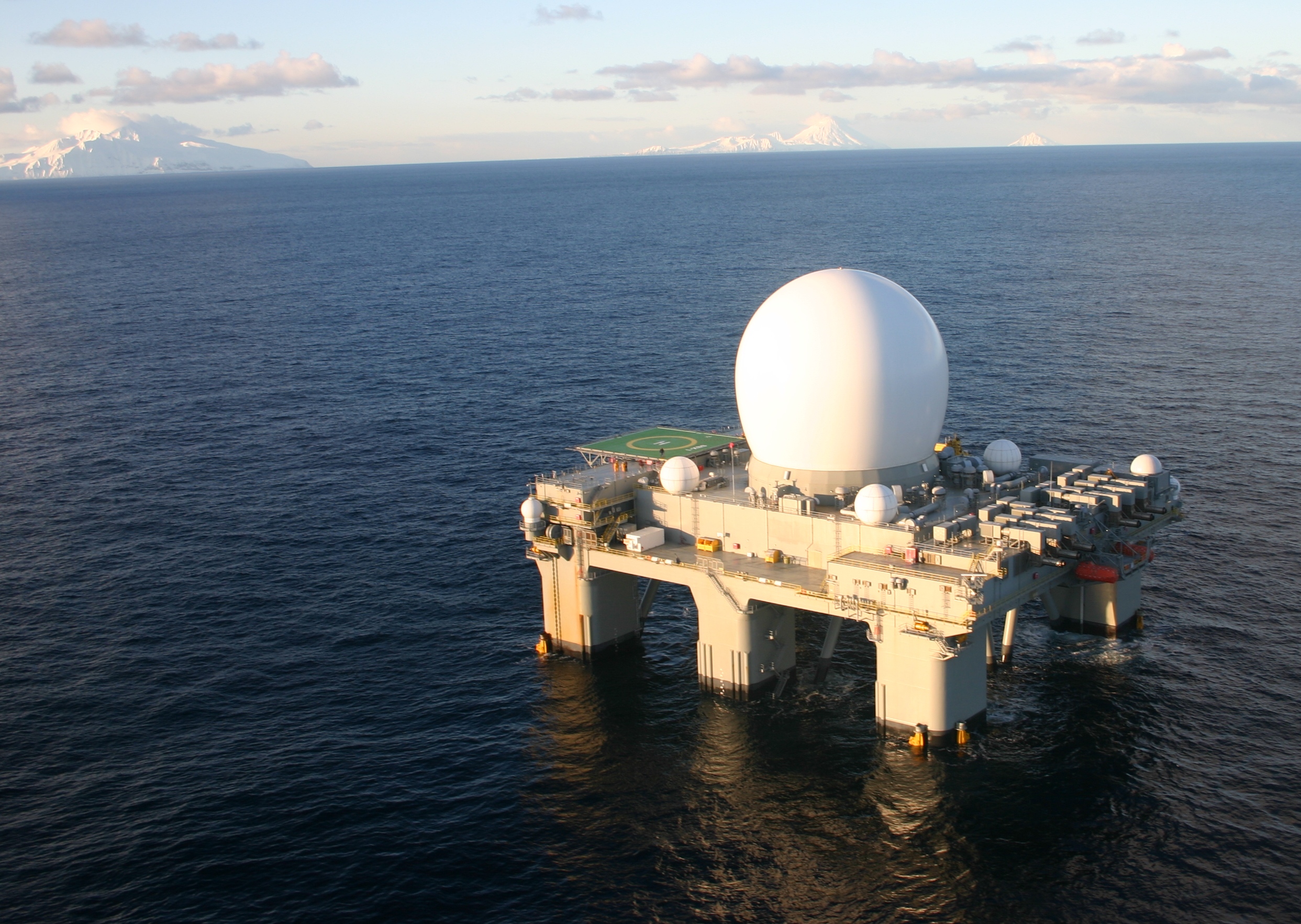
Feb. 2007
In February 2007 the SBX successfully traveled from Hawaii to the waters of the Aleutian Island chain of Alaska. It departed Pearl Harbor, Hawaii on Jan. 3, and conducted numerous sea trials and exercises while en route to Alaska, and also continued the calibration of the X-band radar mounted on top of the ocean-going platform.


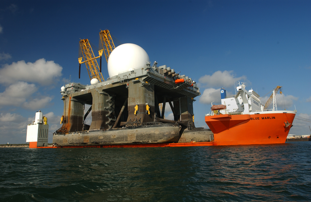
Jan. 9, 2006
The Sea-Based X-Band radar arrives in Pearl Harbor, Hawaii, aboard the heavy lift vessel Blue Marlin on January 9, 2006, passing behind the U.S.S. ARIZONA Memorial.


April 3, 2005
The 2,000-ton radar is lowered aboard the converted oil rig in what will become the Sea-Based X-band Radar (SBX) for the Missile Defense Agency. The assembly took place at the Kiewit Offshore Services in Corpus Christi, Texas. The 282-foot high structure will displace nearly 50,000 tons when at its operating draft. The SBX, a unique combination of an advanced-radar with a mobile, ocean-going, semi-submersible platform will provide the nation with highly advanced ballistic missile detection and will also have the capability to discriminate hostile missile warheads from decoys or countermeasures. Its mobility gives it the capability to be positioned on the ocean to support Missile Defense Agency tests and also operationally support defense of our homeland, deployed forces and allies and friends. The SBX will be homeported in Adak, Alaska later this year.

Space Tracking and Surveillance System (STSS)
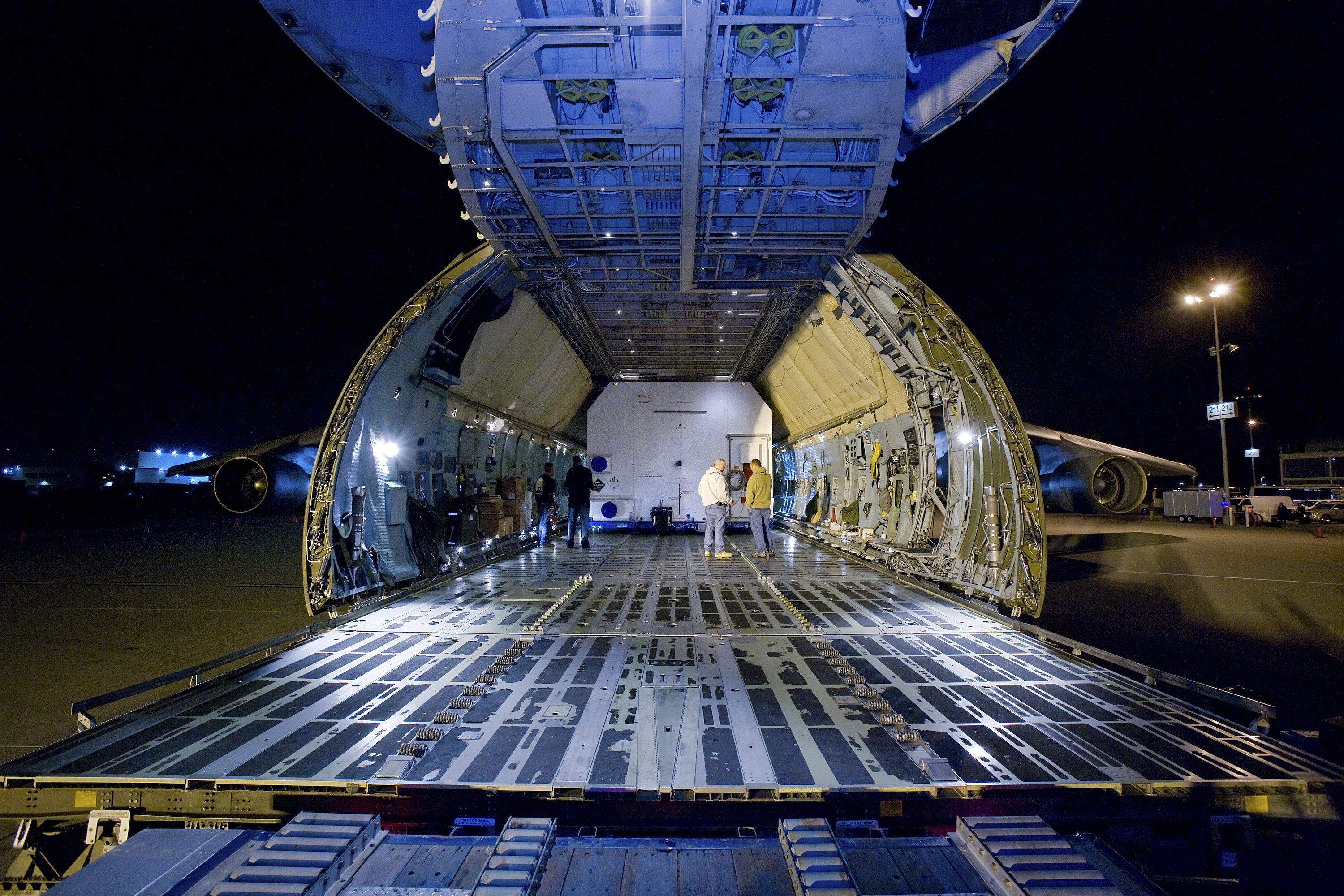
Sept. 25, 2009
The Space Tracking and Surveillance System — Demonstrator, or STSS-Demo, spacecraft lifts off through a cloud of smoke from Launch Pad 17-B at Cape Canaveral Air Force Station aboard a United Launch Alliance Delta II rocket. It was launched by NASA for the Missile Defense System. Launch was at 8:20:22 a.m. EDT on September 25, 2009. The STSS-Demo is a space-based sensor component of a layered Ballistic Missile Defense System designed for the overall mission of detecting, tracking and discriminating ballistic missiles. STSS is capable of tracking objects after boost phase and provides trajectory information to other sensors. (First Photo credit: NASA/Jack Pfaller; Subsequent Photo credit: Regina Mitchell-Tom Farrar)


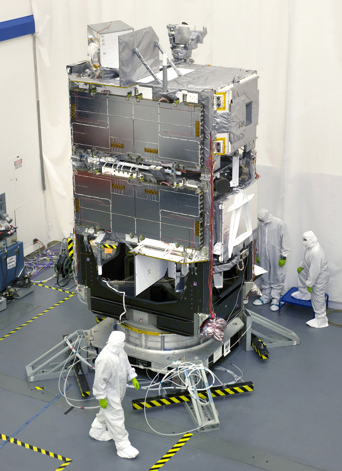
June 22, 2009
Both of the U.S. Missile Defense Agency's Space Tracking and Surveillance System demonstration satellites are shown in their stacked configuration at Northrop Grumman's Aerospace Systems sector in Redondo Beach, Calif., during final integration and testing. The satellites will strengthen the Ballistic Missile Defense System by demonstrating the key functions of a space-based sensor.

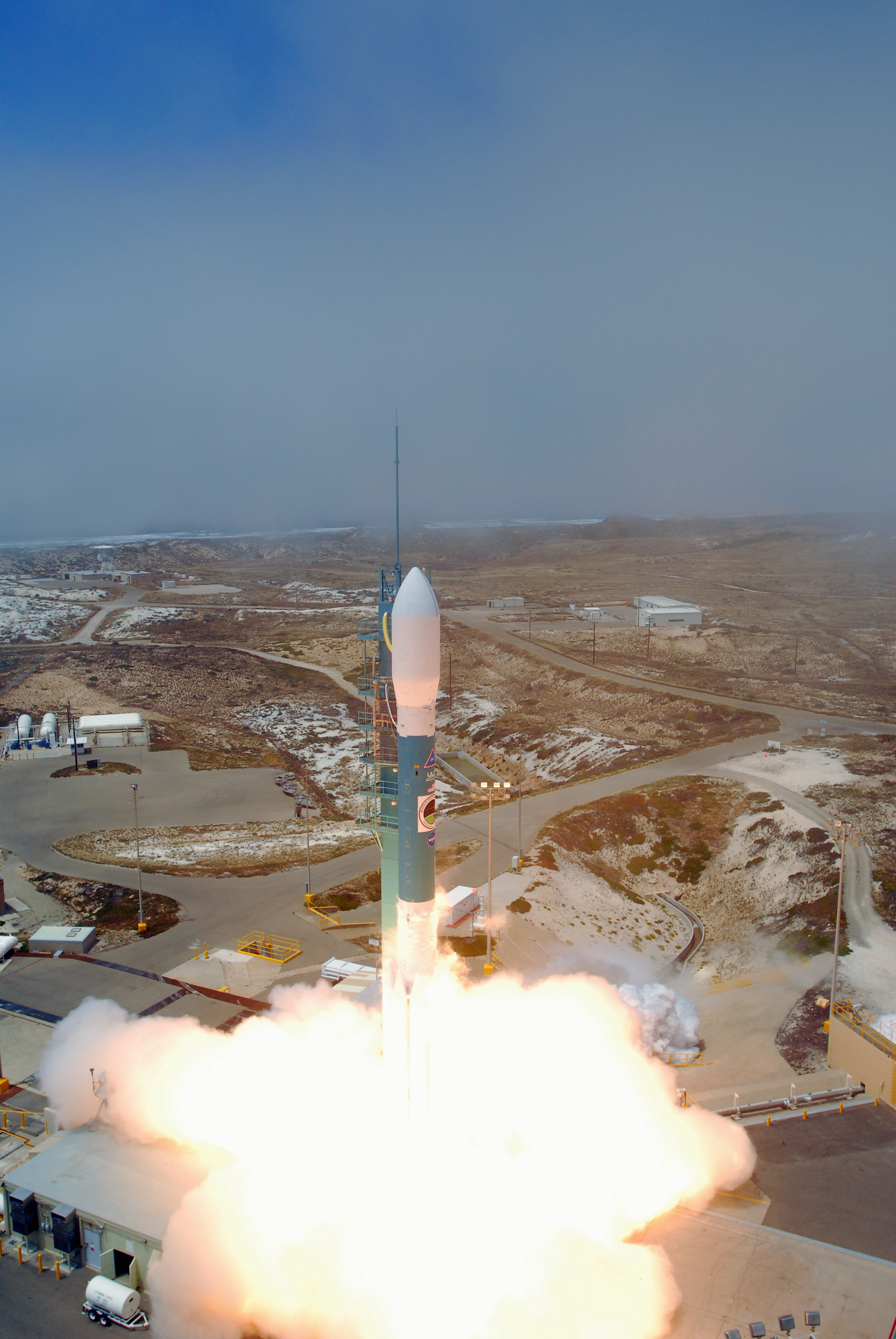
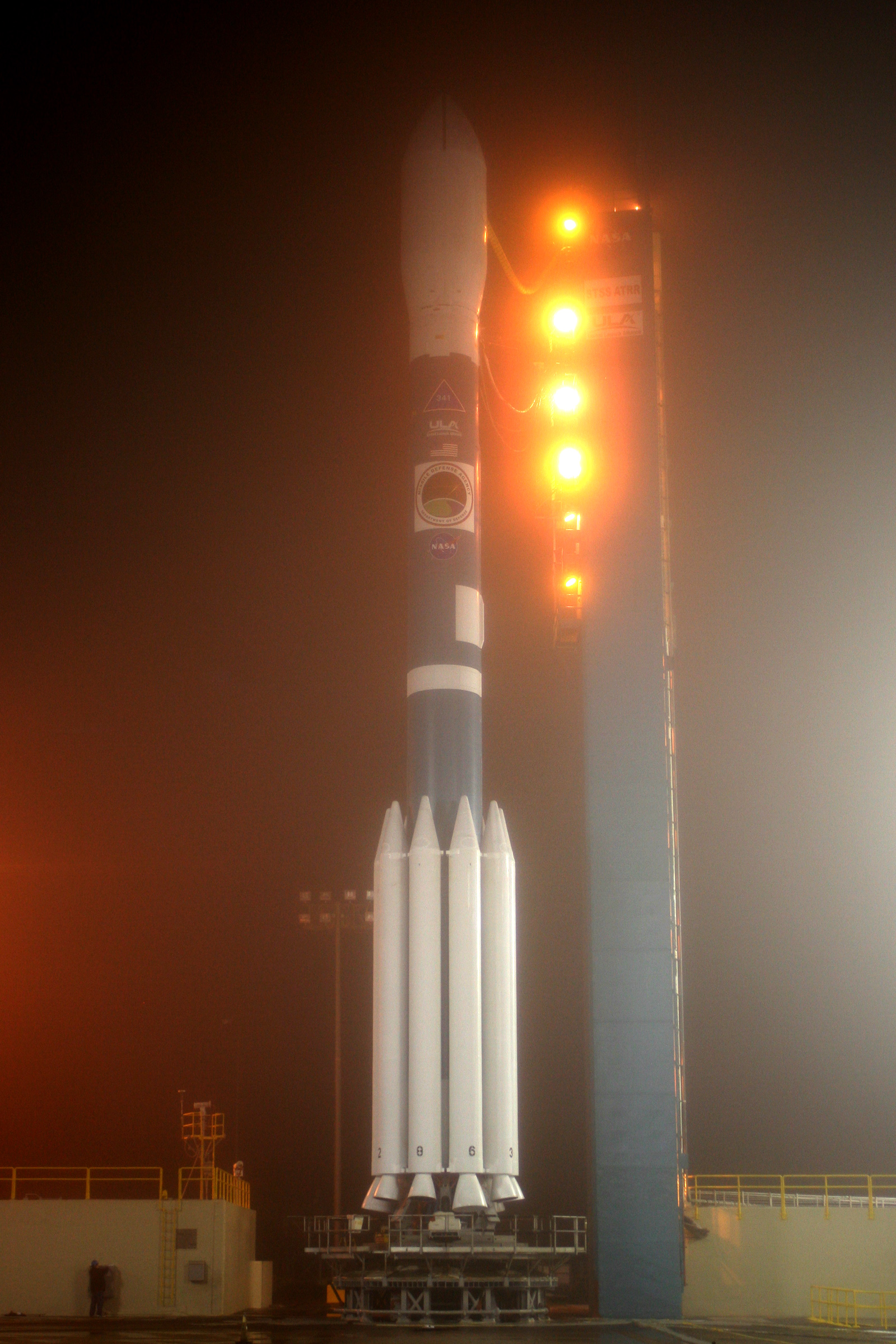
May 5, 2009
On May 5, 2009 the Delta II Space Booster on Space Launch Complex II is readied for launch at Vandenberg Air Force Base, Calif. The booster will carry the STSS Advanced Technology Risk Reduction (ATRR) Satellite into space for use in future MDA space missions. (U.S. Air Force Photos)


Nov. 29, 2007
The second of two Space Tracking and Surveillance System demonstration satellites completed thermal vacuum testing at Northrop Grumman facilities in Redondo Beach, Calif. Testing was done to confirm the satellite will operate according to its specifications in its space environment.


Selected STSS Photos


Both STSS Demonstration satellites are shown in their tandem flight configuration in this artist's concept.

An STSS demonstration satellite is shown in flight in this artist's concept.

STSS demonstration satellite's sensor payload illustrated.

This illustration shows the tandem launch configuration for the STSS demonstration satellites.

Aegis Launch on Remote Capabilities: The yellow area shows the area defended by Aegis radar alone. The green area is the area defended by ground radar if cued by other BMDS assets. The violet area shows the area defended using STSS information to launch and engage threat.

Army Navy / Transportable Radar Surveillance (AN/TPY-2)
Oct. 25, 2012
An Army Navy / Transportable Radar Surveillance (AN/TPY-2) positioned in the Kwajalein Atoll during the FTI-01 flight test. The AN/TPY-2 radar tracked the ballistic missile targets and provided data to missile defense systems to engage and intercept.

Click here for more images from this flight test:
AN/TPY-2
PAC-3
THAAD
Dec. 2-3, 2009
AN/TPY-2 Equipment during an ice test at the McKinley Climatic Lab, Eglin Air Force Base, Florida.


Aug. 7, 2009
AN/TPY-2 Radar System at -28C during natural environment testing at the McKinley Climatic Lab, Eglin Air Force Base, Florida.

October 24, 2008
AN/TPY-2 in Juneau, Alaska.


Selected AN/TPY-2 Photos


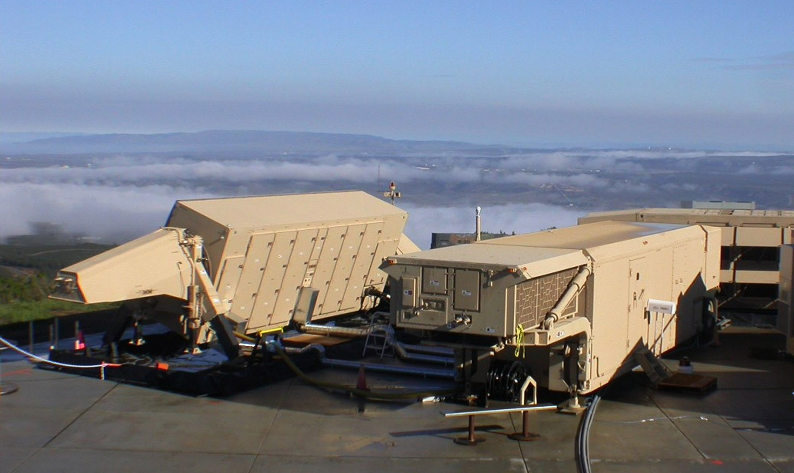
AN/TPY-2 operating in Forward Based Mode at White Sands Missile Range, New Mexico, in preparation for a flight test.

AN/TPY-2 Cooling Equipment Unit (Left) , Antenna Equipment Unit (Right) , and Electronic Equipment Unit (Center) operating in Forward Based Mode at Wake Island in preparation for Flight Test FTM-15.

AN/TPY-2 Antenna Equipment Unit operating in Forward Based Mode at White Sands Missile Range, New Mexico.

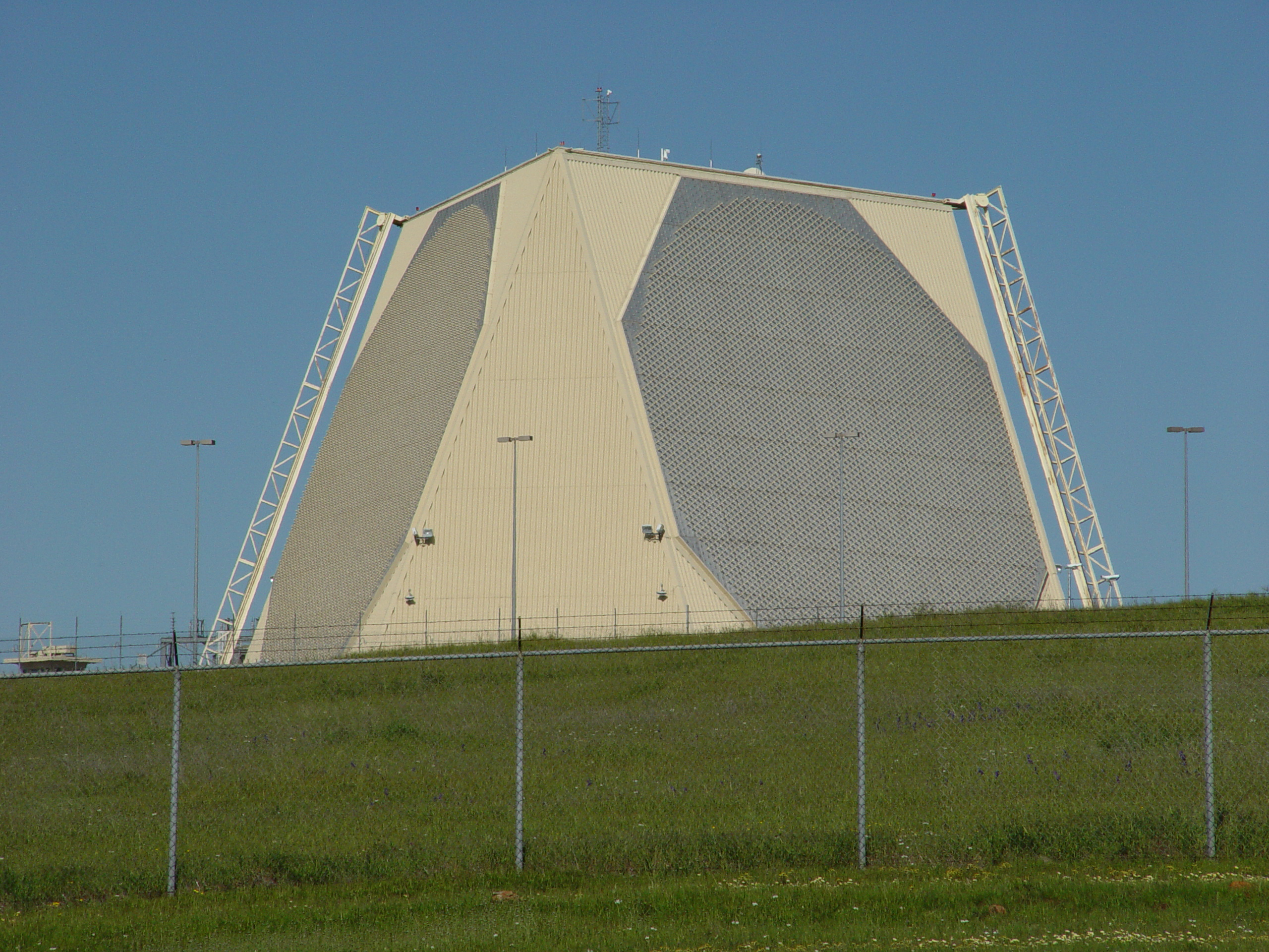
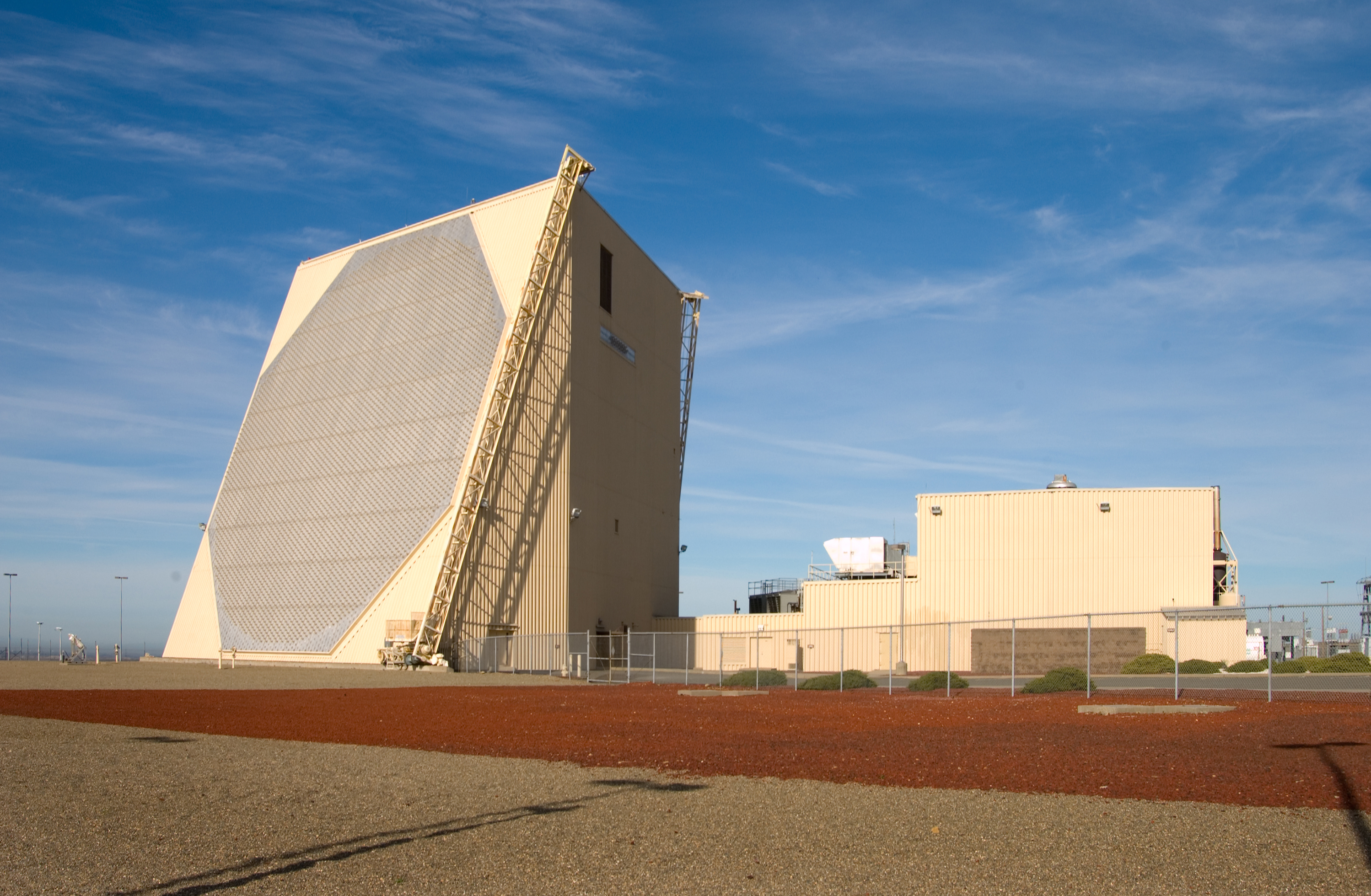
Upgraded Early Warning Radars (UEWR)
Beale Early Warning Radar located at Beale Air Force Base, Calif.
Early Warning Radar at Clear Air Force Station near Anderson, Alaska, and the view from the roof of the radar.


Thule Upgraded Early Warning Radar (UEWR) at Thule Air Base, Greenland, and the view from the roof of the radar.


Fylingdales Upgraded Early Warning Radar (UEWR) at Royal Air Force Station Fylingdales, England.


Aerial view of Cape Cod Early Warning Radar (EWR), Cape Cod Air Force Station, MA. The Cod radar is being upgraded to an Upgraded Early Warning Radar under a future Missile Defense Agency contract.

Near Field Infrared Experiment (NFIRE)
Sept. 23, 2008
At 11:57 pm PDT, September 23, 2008, a modified Minuteman II booster vehicle with a simplified target payload was launched from Vandenberg Air Force Base, Calif., and was successfully tracked by the orbiting Near-Field Infrared Experiment (NFIRE) research satellite. (USAF Photos)


Aug. 23, 2007
On August 23, 2007 a modified Minuteman II booster vehicle was launched from Vandenberg Air Force Base, Calif. and was successfully tracked by the NFIRE satellite.

April 24, 2007
On April 24, 2007 the Near Field Infrared Experiment (NFIRE) satellite was successfully launched from the NASA Space Flight Facility, Wallops Island, Virginia. The primary mission of the NFIRE satellite is to collect high and low resolution images of a boosting rocket to improve understanding of missile exhaust "plume" observations and plume-to-rocket body discrimination during three plume signature types: targets of opportunity, dedicated missile fly-bys, and ground observations. (Photos courtesy of NASA)


Cobra Dane
Cobra Dane Radar at Eareckson Air Station, Shemya Island, Alaska.
